I suppose we were lucky. A lot of areas in the North East had it a lot worse than us. Vermont had huge floods, as did Greene County to the south of us, which you can see in the image below.
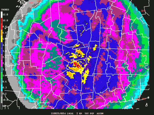
This is a map of rainfall as measured by the local radar. There are errors associated with measuring rainfall this way but it gives a good indication of rain distribution across the local area. The radar shows 3-4 inches around Albany, but rain gauges at the weather service office and airport measured 5.1in and 5.33in respectively.
Coming from Texas - where the drought is still ongoing - this felt like a lot of rain! We left Texas in July, and the hot, dry summer was already wearing very thin. This year has been massively dry and hot, as you can see from the scatter plot below (from an article by John Nielsen-Gammon, Texas state climatologist and professor at Texas A&M).

WOW!! I think my energy bill would have been through the roof if I'd stayed through August. Here's hoping for some relief for all those I know living and working in Texas and I won't tease you with stories of rain any longer.
No comments:
Post a Comment